Mountaneering and hiking
People have always spent time in mountains,whether for economic, military or scientific purposes. Mountaineering appeared like a recreation activity in a period of Austro-Hungarian government. Thus, the private visit of the prince Rudolf of Habsburg was noted down because the hair of the trone was a passionate orintologist and a hiker as he climbed the path from Orjen saddle to Zubacki kabao. After the World War II hiking is set as an independent activity, and the first local mountaineering clubs were established then. (In Dubrovnik 1928. And Herceg Novi in 1932.)
Odmorište na stazi preko Malog Vratla 
Tradicionalni događaj, noćni planinarski uspon na Subru 
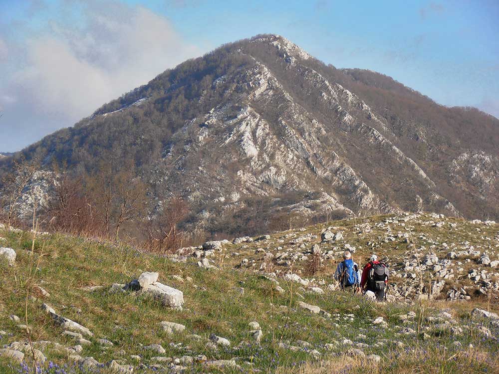
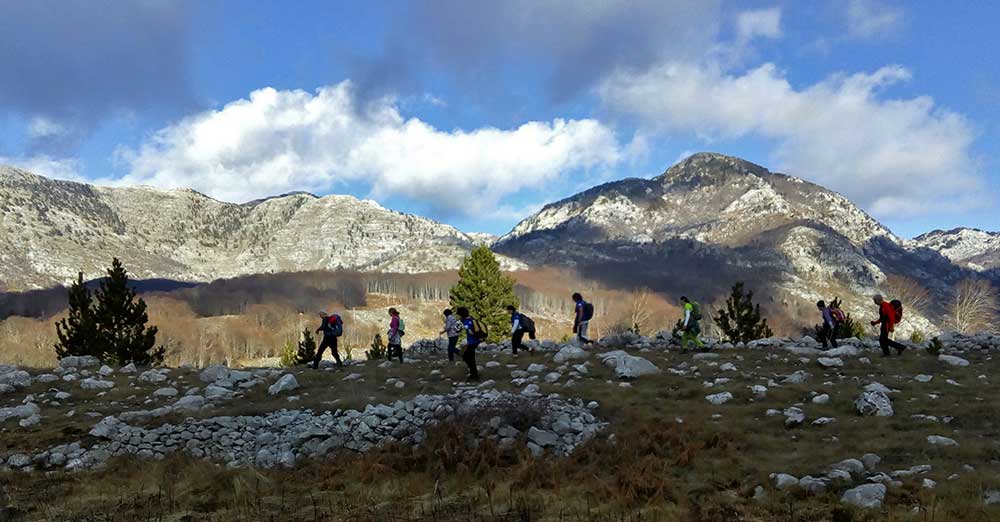
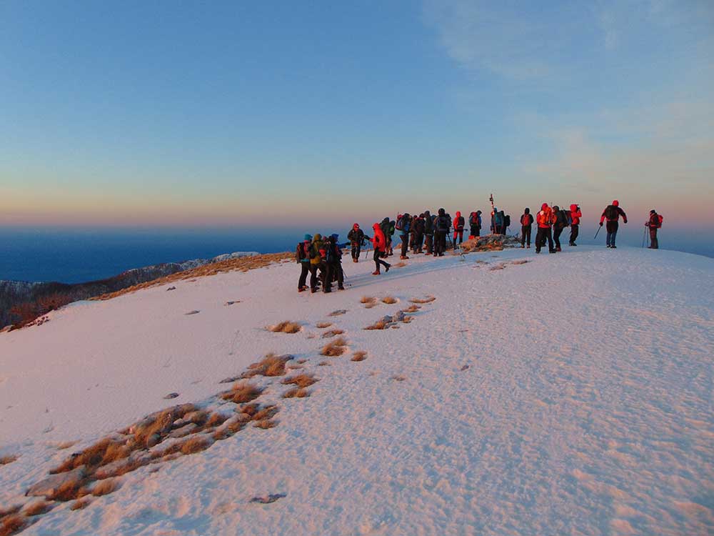
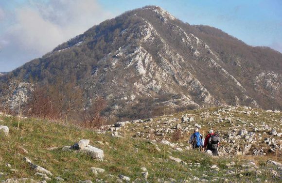
Zimsko planinarenje na Veliki kabao 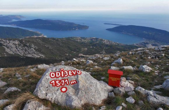
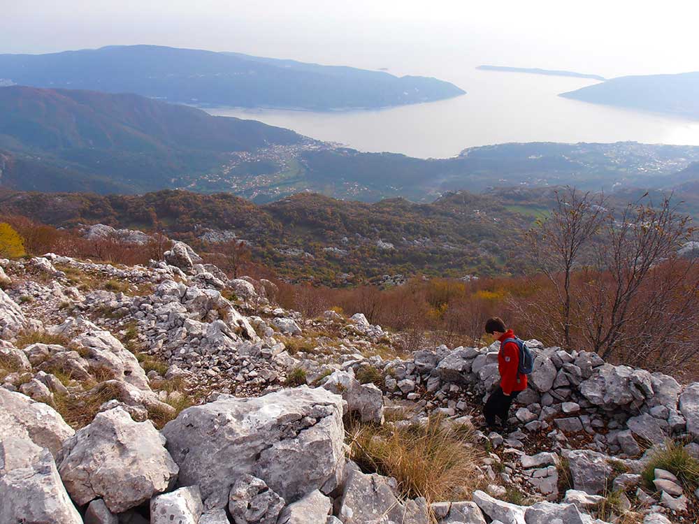
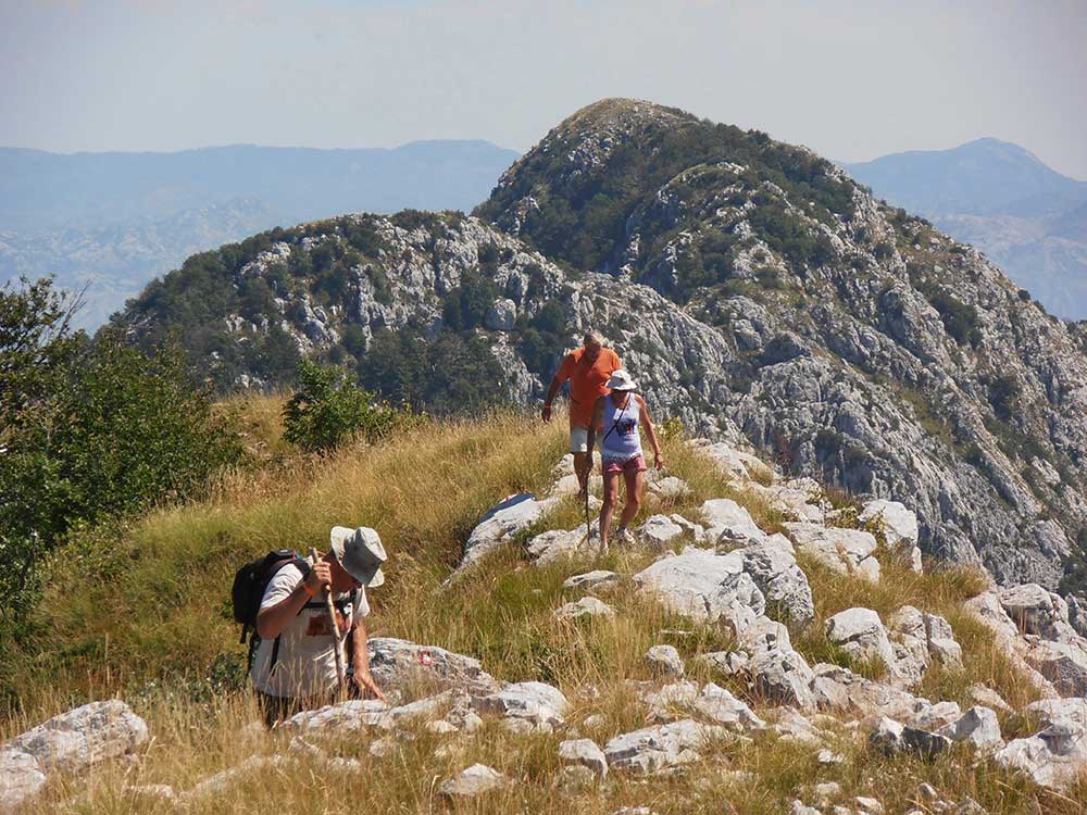
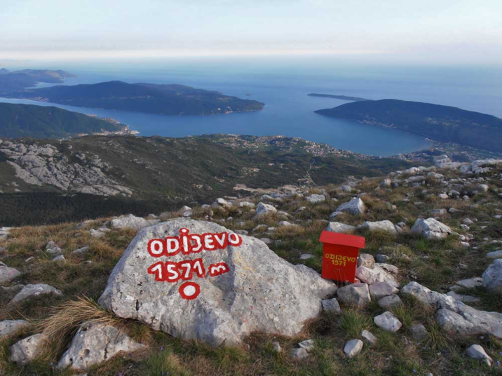
Planinarenje, vrh Odijevo, Park prirode Orjen 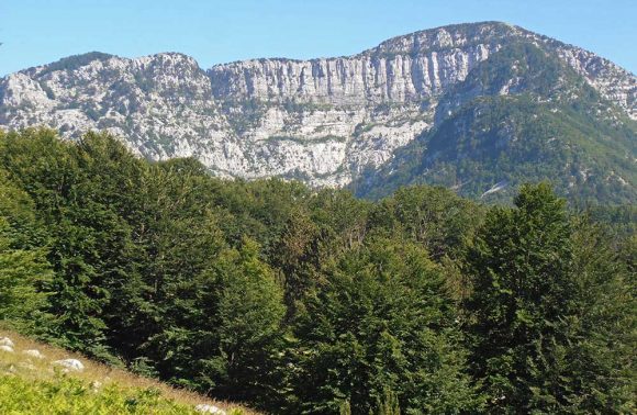
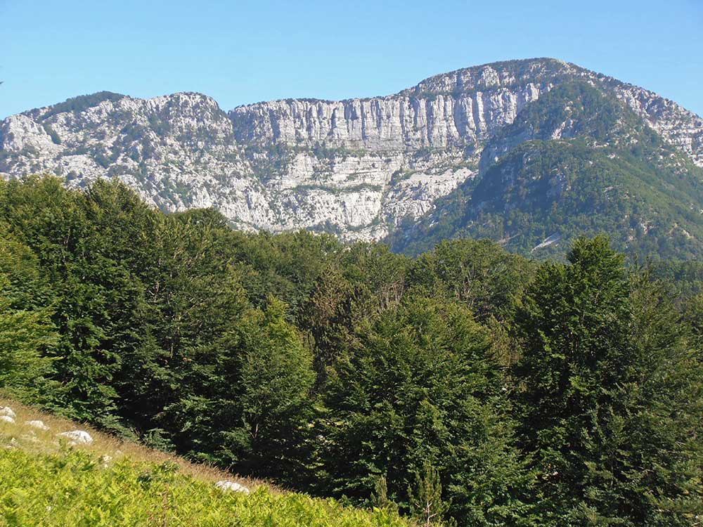
Subrin amfiteatar 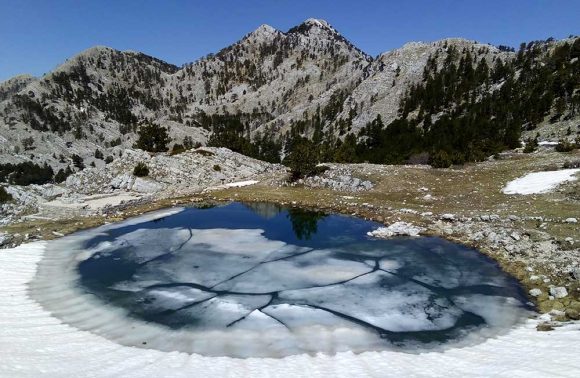
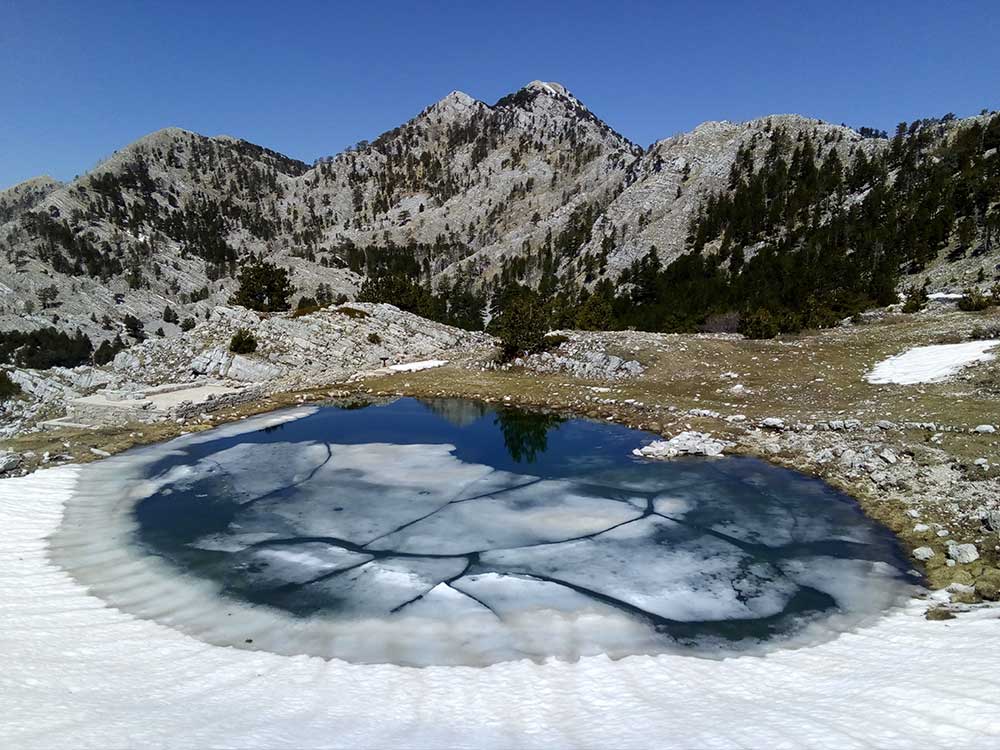
Orjenska lokva i vrh Orjena, april

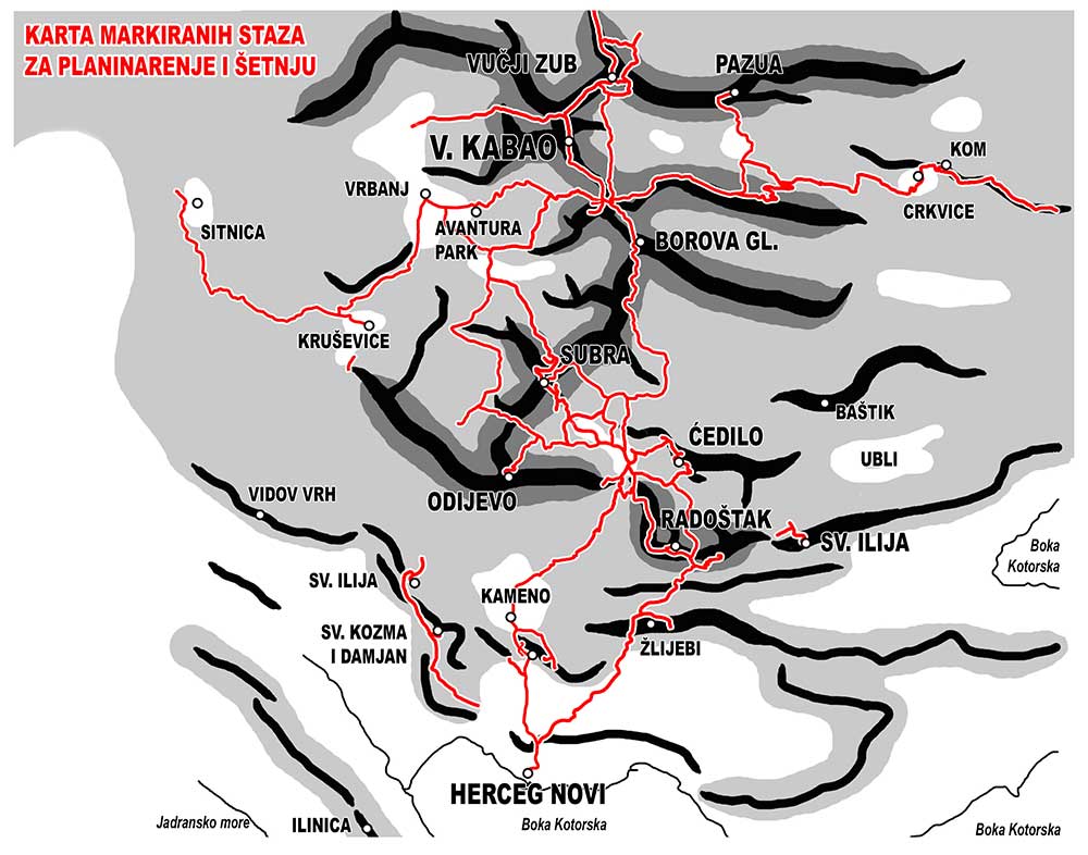
Hercegnovsko zaleđe posjeduje veoma razuđenu i kvalitetnu mrežu markiranih planinskih staza, što planinarskih, što šetačkih, ukupno više od trideset, najvećim dijelom smještenih u okviru Parka prirode „Orjen“:
Herceg Novi – Kameno – Borici mountain hut „Za Vratlom“
This path is good for hiking, except for the big altitude difference. It is the main pedestrian communication between Herceg Novi and Orjen., as well as a road to the mountain transversal Orjen-Lovcen-Rumija.
Tatar bašta – Suscepan – Ratisevina – Mokrine
This path is near the city, it is connecting villages in the hinterland and churches-sightseeings. It is good for walking and hiking. It is more plesant touse it in a less warm period of the year.
Herceg Novi – Zlijebi – Zlijebska lastva
Path for mountaineering, very attractive with an exceptional vew of the entrance of Boka Kotorska. It is more pleasant to use it in the cold period of the year.
Zlijebska lastva – Sedlo – Careva rupa – mountain hut „Za Vratlom“
A mountain track that starts from the well known excursion site with a great view of the Bay, further going through the beech wood.
Karaula – St Ilija
A short path, demanding in the end, with a great view of Boka Kotorska and Lovcen.
Perov do – Malo Vratlo
An attractive path that one could take instead of the macadam road to mountain hut “Za Vratlom”, in a form of serpentine, and many resting places along. It is convenient for walkers but as the entrance of the south part of the massif, throughout the year, except in snowy weather
Mountain hut „Za Vratlom“ – Siljevik – Robodo – Vranjaj – Radostak – Sedlo
It is not an easy track, but surely is a track that offers remarkable views of the coast of Montenegro and inner sections of the mountains. It is more pleasant to use this track when the weather is not too hot.
Zlijebska lastva – Rt
Mountain track that goes through the hornbeam grove to the top where there was an ausro-hungarian watchtower, which is a guarantee for the great view from that point.
Mountain hut „Za Vratlom“ – Zlijebska jama – Veliko cedilo
A path that goes to Zlijebska jama (an interesting speleo-archeological site), convenient for treking as well.
Mountain hut „Za Vratlom“ – Grab – Veliko cedilo
It is the only longer hiking trail that goes to a certain top, and is suitable for hiking all way to Grab, where there are remains of austro-hungarian boarder post. The rest of the trail goes to Veliko cedilo and is more demanding.
Mountain hut „Za Vratlom“ – Kamenski kabao
Short, but more demanding track that goes to the top, steepingly rising on the west side of the Vratlo notch.
Mountain hut „Za Vratlom“ – Vilino gumno – Subra
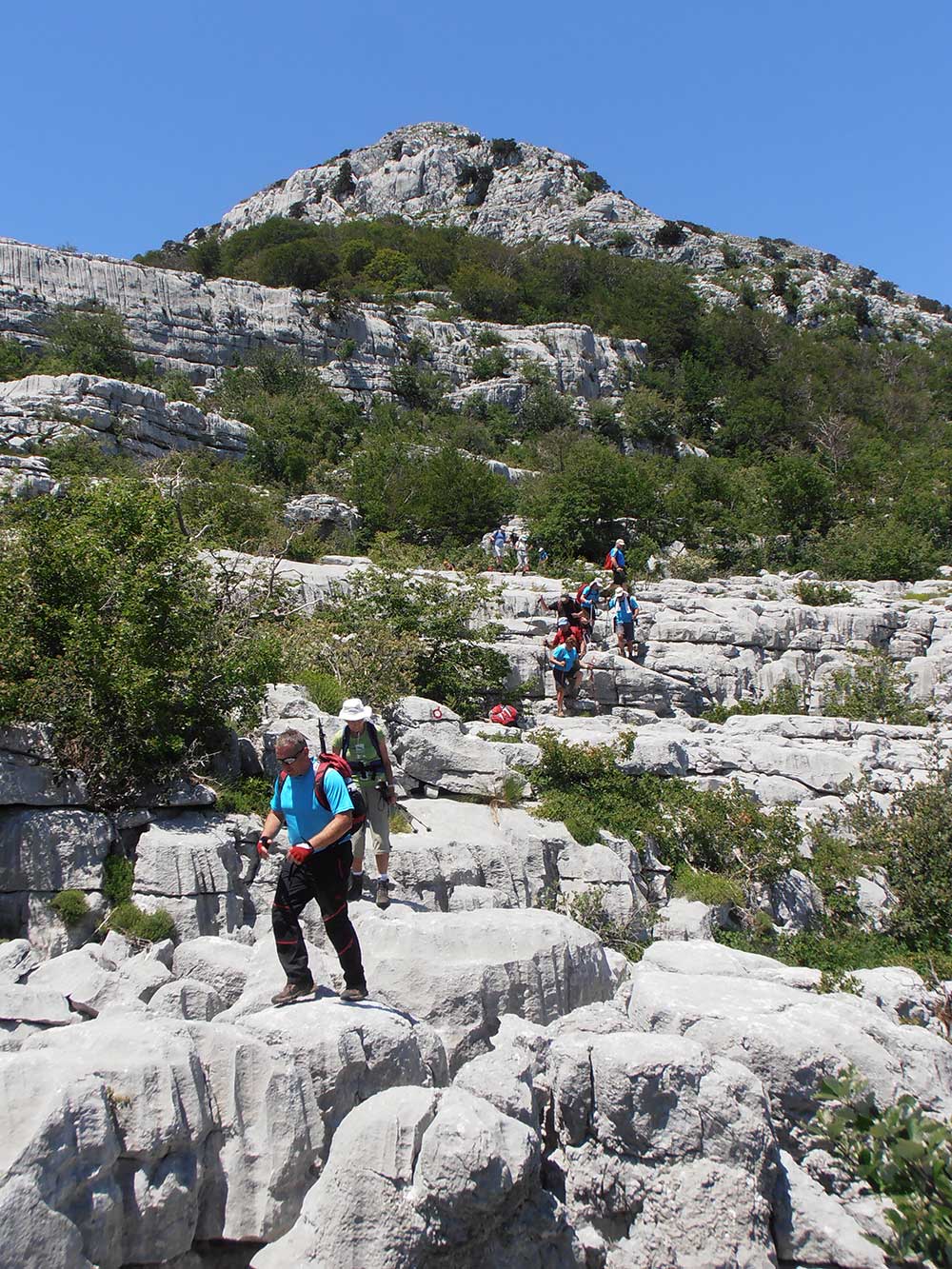
This is the most attractive and most frequent mountain trail in this part of massif. A distinct karst relief ,remarkable view points from the top all way from the Albanian coast, over Montenegro, east Hercegovina up to Middle Dalmatia.
Mountain hut „Za Vratlom“ – Simova pecina – Subra
It is a more challenging trail, leading to the same attractive destination. It is usually used to go up the hill,and another, more convenient way, is used to come back.
Mountain hut „Za Vratlom“ – Potkape – Vučji do – Rujišta – Trešnja
It is a trail convenient for hiking (except its middle part), passing around Subra, offering numerous views of this beautiful mountain,going through manageable paths surrounded with beech trees and pastures.
Mountain hut „Za Vratlom“ – Borova glava – Orjensko sedlo
It is a mountain trail connecting south and the middle part of Orjen massif,and it enables going to the main peak,Veliki kabao.
Sljeme – Odijevo
Mountain trail through the beech woods leading to the best view point of the Massif. It enables great view of the Bay and the sea shore, and the interior areas of the Mountain as well, with Subra as a dominant section.
Vrbanj – Sitnica
Mountain trailk that connects Vrbanj with the boarder crossing with BiH, ”Sitnica”. It’s a track convenient for hiking, except a short section above Krusevice village.
Vrbanj – Begova munika
A trail convenient for hiking as well. In the great part it follows an old military road, going through the shade of a beech tree forest. It joins the mountain trail which is leading to the passage Orjensko sedlo.
Vrbanj – Tresnja
This track is convenient for hiking as well. It will take you to the rest spot with a great view, on Tresnja hill. There the path diverges into various directions, leading to other destinations.
Tresnja – Rujista – Zukovica – Snijezna jama – Markov kos – Subra
The section to Zukovica, even to Snijezna jama is a trail convenient for hiking, thus represents an attractive hiking trail, with a remarkable view of Subra Amphitheatre. From that point it is a distinctively mountain trail, but attractive as well as it crosses Markov kos (Subra Amphitheatre), the most interesting detail of subadriatic Dinarides.
Tresnja – Orjensko sedlo
Mountain trail, part of the transfersale Orjen-Lovcen-Rumija. Going through the shades of beech tree forest, munica groves, endemic pine species that Orjen is known for.
Poduge – Medjugorje – Veliki kabao
Mountain track, at the beginning adequate for hiking, but with the rise in altitude getting more and more demanding. Upper section,convenient for mountaineering, offers a wild nature soroundings, abundant in municas and karst ridges.
Orjensko sedlo – Veliki kabao
Mountain track which offers the easiest way to climb up to Veliki kabao,the highest peak of Orjen, as well as the highest point of the Adriatic Dinarides. It represents the first purposely made path in Montenegro. (middle of the second half of 19th c.)
Orjensko sedlo – Kosmas
A short mountain track to the nearest mountain peak above the passage Orjensko sedlo. It leads through munica forest,an endemic pine species. Entire Orjen massif is visible from the peak.
Orjensko sedlo – Prasa – Vucji zub
This mountain track is leading to the one of the most challenging peaks of the Massif, on the boarder with BiH.
Vučji zub – Reovacki prevoj – Keseljevi katuni
It is a following segment of the previously mentioned track. It leads to the side,northern part of Orjen, into Bjela gora. This track runs through very attractive karst terrain.
Keseljevi katuni – prevoj Preslo
A short track right to the boarder with BiH. Runs through a beech forest up to the passage,which is a crossroad,track and a nice viewpoint as well.
Prevoj Preslo – Jastrebica
Mountain track along the boarder with BiH. It goes to the second peak in altitude in the Orjen Massiv.
Prevoj Preslo – Vucji zub
It is a demanding mountain track running through the remarkable karst relief areas, interspersed with munica trees.
Reovacki dolovi – Pazua
A demanding mountain track that leads to the most harsh peaks of Orjen. A distinctive karst areas interspersed with municas.
Orjensko sedlo – Crkvice
A track convenient for hiking as well, for its long section is actually an old austro-hungarian macadam road,and along the north forest covered side, which provides a pleasant shadow even in the hottest days.
Crkvice – tvrđava Kom
A short track that goes to the austro-hungarian fortress, situated on the peak above Crkvice. It is adequate for hiking.
Kom – Velji vrh
This path follows the old austro-hungarian pedestrian route, so that it could be adequate for hiking, if it weren’t too long. It runs through the attractive karst, mostly crag like relief, which enables great viewpoints, as the peak itself.
Velji vrh – Grkavac
It is the same, above mentioned road, which leads down, from the other, east side, all to Gornje Ledenice. It is the same type of track as Kom-Velji vrh.
Kamenska ravan i vrh Siljevik 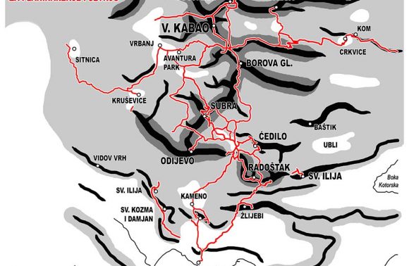
Karta markiranih staza za planinarenje i šetnju 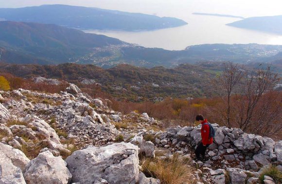
Silazak sa Radoštaka 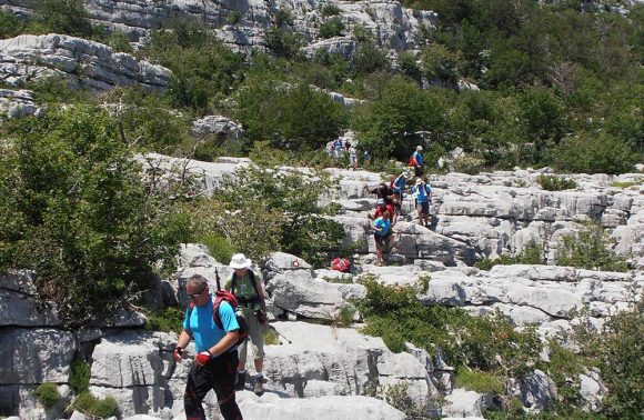
Subrini platoi 
Odijevo 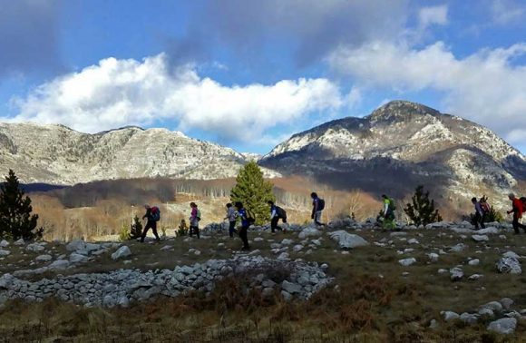
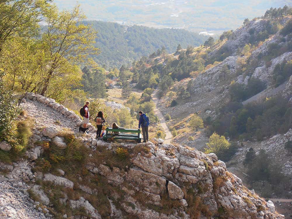
Hiking, okolina Vrbanja 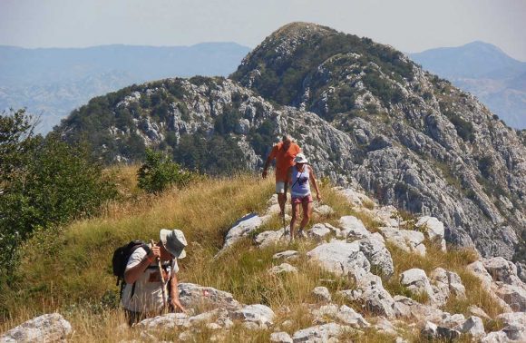
Izlazak na Veliko ćedilo